Seilbahn Hochmuth. I’m sure this funivia has an Italian name, too, but, unlike farther south in the Südtirol, the Italian translation isn’t always available this far north, so learning the German name can be invaluable.
Trail Run Distance: 7.11 mi (11.44 km)
Trail Run Elevation gain: 3522 ft (1074 m)
Summit: Mutspitz/Monte Muta (7526 feet/2294 meters)
People encountered on trail: at least 50, on a Tuesday in October
Total time: 3 hrs, 38 min (including plenty of photo breaks, a couple of layer/delayer breaks, and 20 minutes on the summit of Mutspitz shoveling food into my mouth, signing the summit register, and jumping for posterity)
Forms of transportation, one way: train, 2 buses, funivia
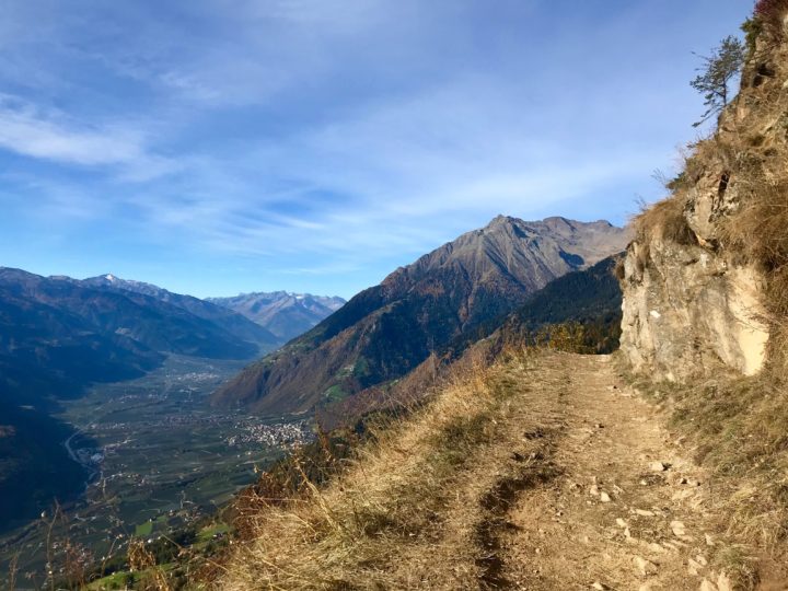
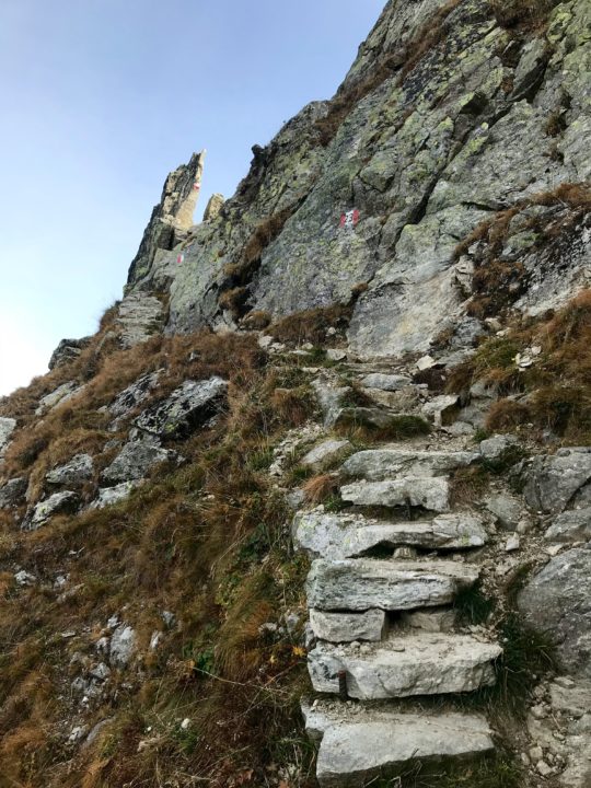
Trail 24, which drops off precipitously to the south, with views up the valley of the Adige to the west.
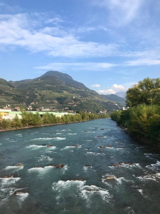
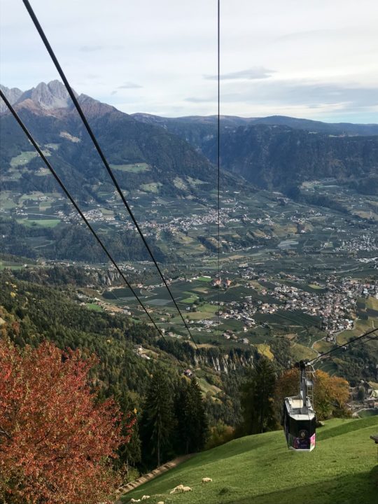
The mountains of the Texelgruppe, or Gruppo di Tessa Natura Park, rise from the north side—the Alps-side—of the city of Merano, at the convergence of the Adige and Passirio Rivers. Those rocky peaks with their ramp-like ridges are really just asking to be climbed.
Looking for an adventurous trail run, I couldn’t believe my luck when I opened my map and found the Mutspitz loop. It looked short enough to do during a school day, if my husband wanted to join me (although he wanted to, he wasn’t sure we’d be back in time, so I went solo); and I’d get up into those mountains that I’d been admiring from afar.
After a train from Bolzano to Merano; then bus 221, which runs every 15 minutes, from the Merano train station to the Tirolo bus station; followed by bus 222, which also runs every 15 minutes, to the Seilbahn/Funivia, I bought my €10 andata e ritorno (round-trip) ticket and stood in line with 40 or so other hikers and a dog, awaiting my turn in the 20-person funivia car.
In Oberhochmuth, I chose to run my route clockwise, heading toward the Steinegg gasthof (guesthouse) on trail 24. I think, in retrospect, I’d prefer the counter-clockwise route. I chose clockwise because the steepest section was on the first part of my route, and I didn’t want to come down it. But, really, both sides are steep, and the crazy cobblestone-like rocks laid in the trail to prevent spring mud and summer dust was quite challenging on the way down. It offered a constant tripping hazard, and the continuous pounding downhill on hard rocks hurt my feet through my thin trail shoes.
Steinegg has a beautiful panoramic vista with mountains marked along the rail (and amazing viewfinders that, when you turn them, identify in text what mountains you’re looking at!). After that, trail 24 is nearly level, traversing the mountain with wide-open views to the south and plenty of benches positioned to enjoy the sun—hence the trail’s popularity. “Morgen!” or “Grüß Gott!” I said, dozens of times, as I passed hikers on the trail.
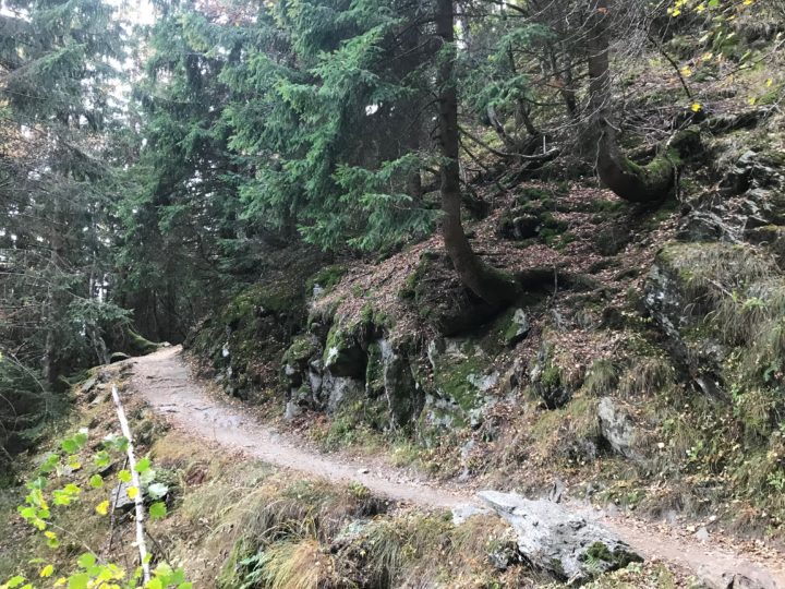
Eventually, I turned uphill on trail 25, into the spruce forest and onto the solid stairs.
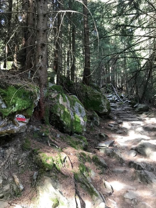
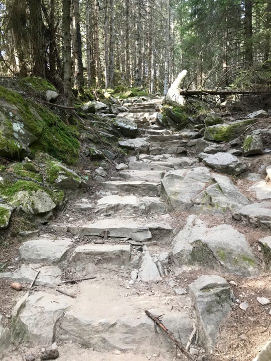
Well, if I have to climb 3500 feet, at least I’d like to have stairs.
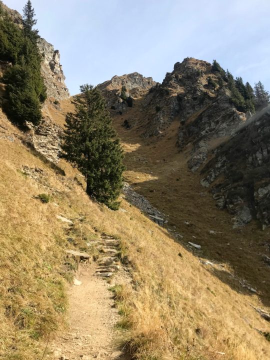
At 3.23 miles, I reached the Taufenscharte, a pass between the yawning Adige valley to the south and the narrow gorge of the apparently unnamed creek to the north (Google Translate informs me that Taufenscharte means “baptize gathered.†Interestingly, this location has another German name which means “yoke of Kar.†Now I want to research the area to find out more about its names.) The last uphill push to the Taufenscharte crosses a steep, grassy gulley with approximately 18 switchbacks. It’s a heartbreaker.
By gulley, that was difficult.
At the Taufenscharte, I ran into a 40-something, German-speaking couple. After realizing our shared language was English, we started talking; and the first thing the man did was mansplain my actions to me. Actually, it was more “guyvice-ingâ€Â (unsolicited guy advice) than “mansplaining.†After asking if I was alone, he said, “Maybe that’s not such a good idea. What if something happens to you?â€
I felt the completely irrational need to explain my actions to him: my husband knows where I am, I’m careful about where I go alone, I have a surprising number of warm layers in my tiny running pack, I would turn around if I felt unsafe or uncomfortable on the terrain. The woman nodded and didn’t look concerned as I essentially ticked off my credentials for why I should be allowed to go for a 7-mile run alone in the mountains on a sunny fall day. I proceeded to put on a couple of layers, take out my topographic map, and eat a tangerine. That’s when Guyvicer asked if he could borrow my map, because he only had a tourist map that didn’t show topography (insert eyebrows-raised look of disbelief).
The route was almost unrelentingly uphill to the Mutspitz, but it always had very good footing.
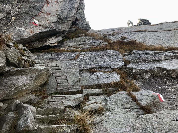
This short section just west of the Mutspitz is the most exposed of the entire trail. It does drop off just as the photo shows.
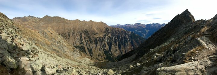
Trail 23, off the north side of the Taufenscharte, headed into the shade, at which point the trail felt truly alpine—no trees; lichen-covered metamorphic boulders, sometimes shining with mica, jumbled among the grasses; and a cold north wind. The trail dipped and rose, climbing some bedrock and eventually heading to the Mutspitz on the occasionally narrow ridge.
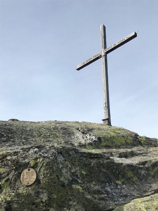
Would it be a summit in Italy without a cross?
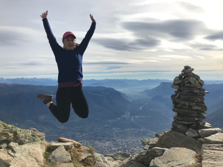
If I don’t look quite certain, it’s because I’m not sure if my landing will involve an ankle sprain.
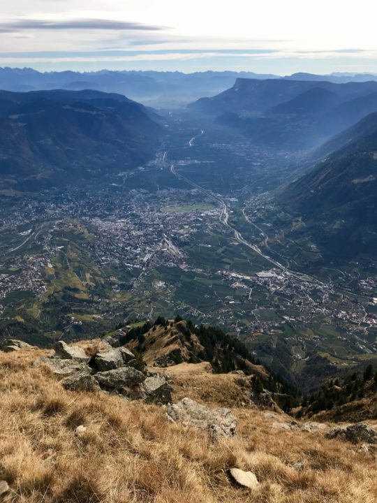
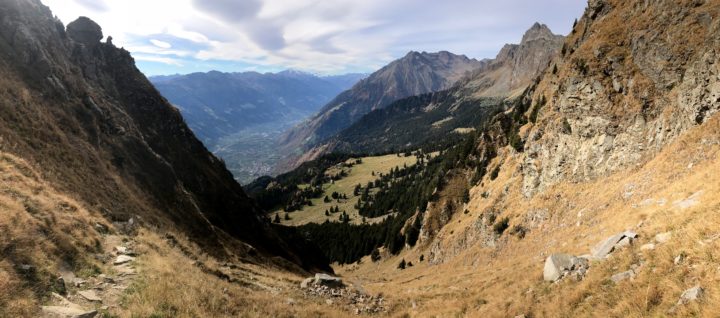
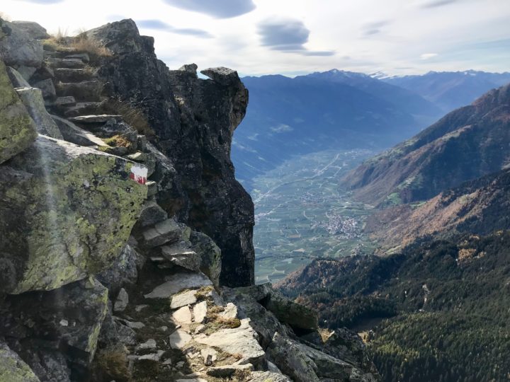
The view south down the Adige valley, with Merano just to the left of center, at the base of the hills. Bolzano is around the corner of the ridge that comes down on the left.
After I’d spent my 20 minutes on the summit writing in the log, eating, and taking some photos, I headed down the golden grassy ramp, beautifully sunny and warm. Then I encountered the crazy cobblestone section and tried to glide down in order to avoid foot-pounding or tripping and finding myself with a broken nose or wrist.
At the Mutkopf Inn, its outdoor tables packed with hikers having streudel, espresso, and beer, I turned south onto trail 22. This is the one section of trail I’d be sad to miss if I reversed this route. I felt like flying down the easy dirt trail, which was never too steep and never too rocky. I was a great way to get downhill.
I found Oregon on my trail run!
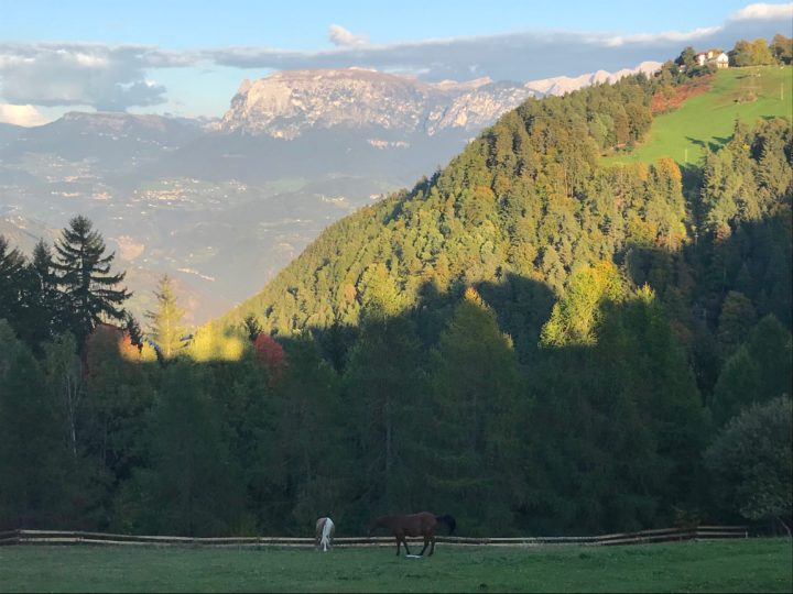
Golden larchlight, with changing foliage across the valley.
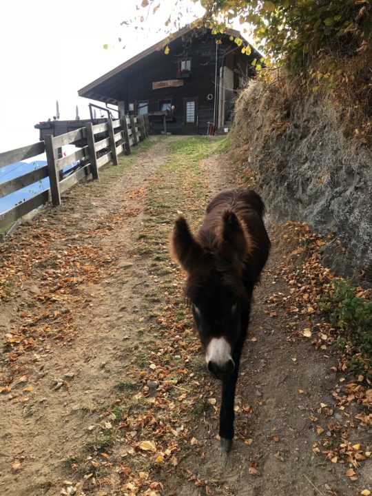
The deep bells of the goats welcomed me back to Steinegg. After I came through the gate, a remarkably soft-haired young donkey walked right up to me, asking for a forehead scratch.
I caught the next funivia down, then the buses ran on time, and I made it back home on the train soon after my family did. Beautiful, difficult, with great views, I would do this hike/run again and again!