Archive for the ‘outdoors’ Category

“Let’s go on a run,” I said: notes from a morning adventure run to the Montiggler Seen/Laghi di Monticoli

Posted by julie on Wednesday, 13 February 2019, 8:32

“The elevation of the lakes is only 500 meters,” I said. “It shouldn’t be snowy anymore,” I said. And yet…

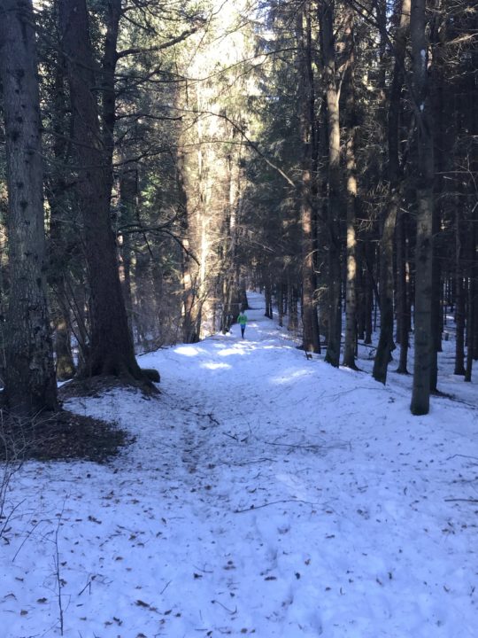
This is what Chris looked like for most of my run: a bright green blur far up the trail.

And yet I underestimated the power of a good forest in shading the snow and preventing melting—and it was largely a deciduous forest, scattered through with just a few pines and firs. It snowed a full 10 days ago, after all; and it’s been pretty sunny since then. But yesterday’s adventure run turned out to be a different run than the one we’d originally planned. And, really, that was fine, because my husband would never complain about any run in the woods—or any morning spent together.
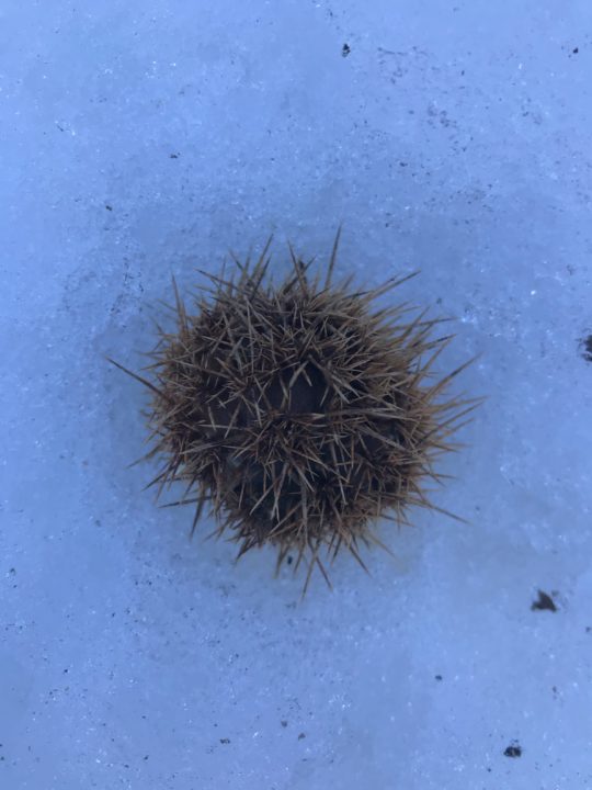
Castagna!


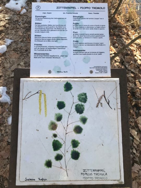
Populus tremula. European aspen.

Once the kids were off to school, we hopped on the next train headed south. We got off just a couple of stops later, in Bronzolo/Branzoll, where Chris found—on his amazing, free Südtirol2Go app—that in just a single minute, we could board a bus directly to the trailhead. Just let that sink in for a minute: we walked to the train station, got on a train, then took a public bus directly to our trailhead, which headed up some stairs alongside someone’s immaculately-kept house before diving into the woods. And that whole trip cost us just a few cents (really a few cents—like a quarter).

As our time in Bolzano hits its downhill slide (we’ve been in this apartment for five months, and we’ll be out in another four), I’ve begun thinking of the things I’ll really miss about being here. Taking public transportation (trains, buses, and funivias) directly to trails tops my list. Trails here nearly always connect directly to a train or bus line; the trails are so plentiful that, even in a decade of trail running directly out of Bolzano, I could probably not run all of the trails. Plenty of trails radiate from the funivias, too; who doesn’t want to take a gondola to their Sunday afternoon hike?

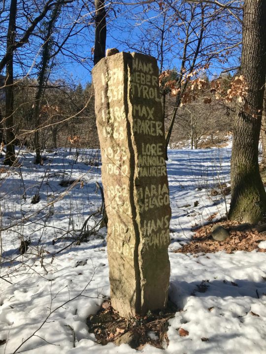
I’m pretty sure we stumbled upon an old graveyard? Maybe?


Ahhhh.


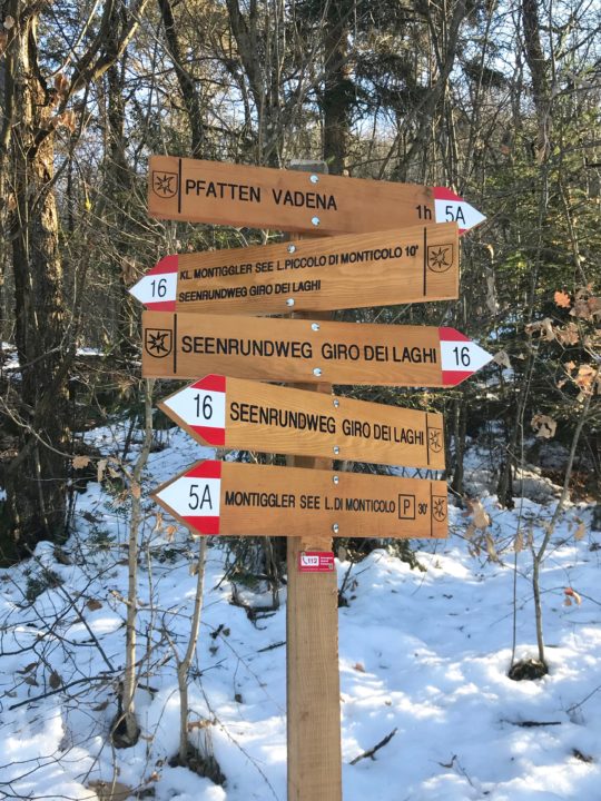
Gorgeous new trail signs.

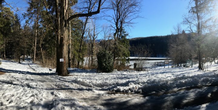
But, anyway, back to the icy, snowy adventure run: The first, quick 250-meter climb, through an east-facing oak forest, was melted out. I slipped and slid on dry oak leaves covering the steep trail. Chris left me in the dust.

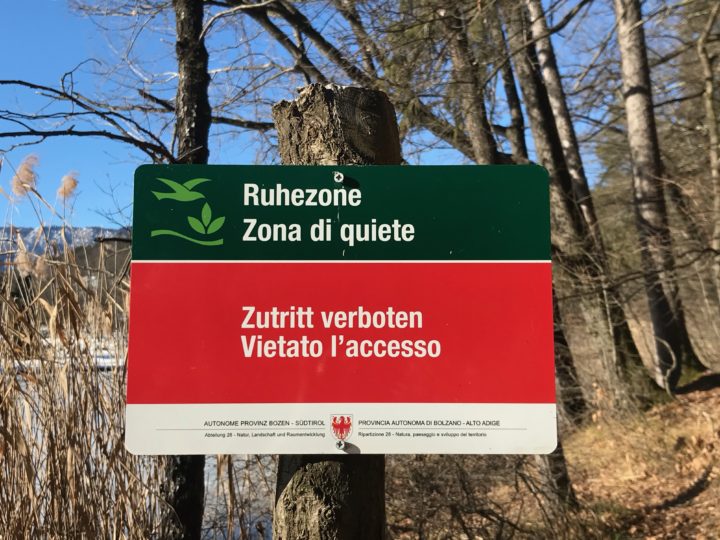
And then we hit the snow. As soon as we topped out on the ridge, snow glowed blue on the forest floor, cooling the air and slowing our steps. Each warm day, the snow had melted, then it refroze into a slick crust at night. We were left with a slippery trail, perfect for knocking middle-agers on our butts. Forging through the snow on the trailside was safer, though it meant breaking through a crust, dampening our feet and irritating our shins.

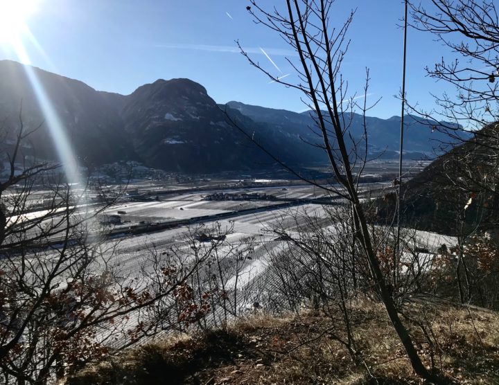
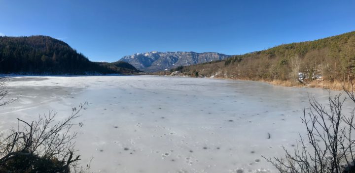
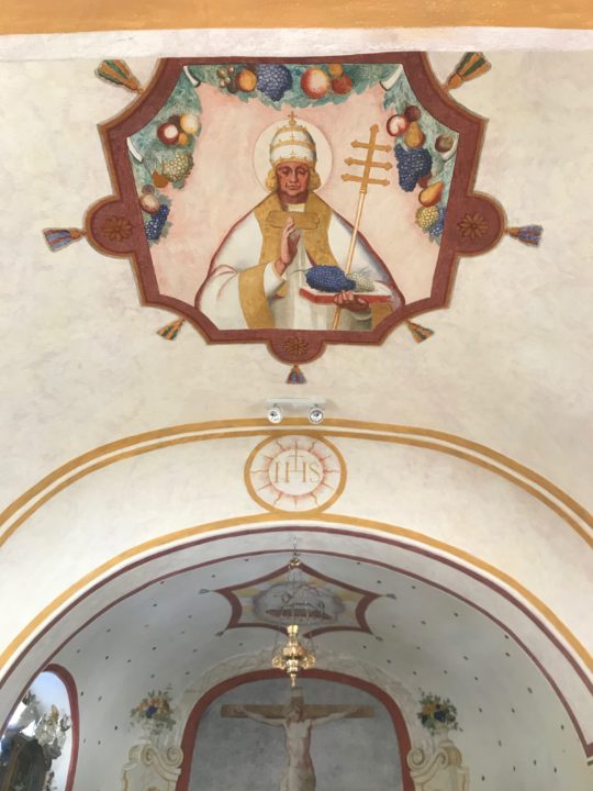
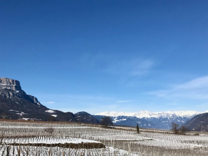
It slowed us down, but that was probably a good thing, because the day was truly glorious. The Montiggler See/Laghi di Monticoli are these little gems tucked into the forest, ice-covered now but undoubtedly swimming magnets in the summer. Birds were everywhere, warming up in the balmy breezes. The sun was out, the sky was blue, and no one was on the trails but us. We found brand-new trail signs, jury-rigged bike jumps, and even an impeccably-maintained 12-seat church (it is Italy, after all), once we’d entered the village of Colterenzio/Schreckbichl, which is currently blanketed with a patchwork of wintry wineries. If this run were snow-free, it’d be fast and easy, with the added bonus of a dip in a lake!


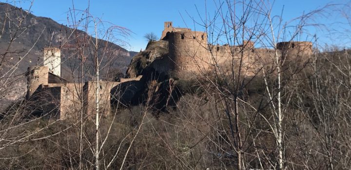
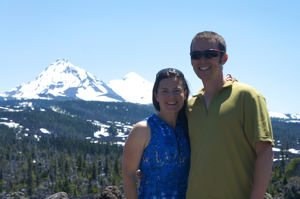
And then, I came around the corner to this. This castle, Schloss Sigmundskron, has an interesting history. Currently, it is the centerpiece of the mountaineer Reinhold Messner’s Mountain Museums. It was built before 1000 A.D. and then owned by a variety of princes and earls through the centuries. In 1957, it was the location of the Südtirol’s largest-ever political demonstration, of 30,000 people, demanding independence (from Italy) for the Südtirol. The Südtirol is now considered an “autonomous area” of Italy, which means that it has greater self-government and pays a smaller portion of its taxes to Rome than other Italian provinces.

And then it was over. We passed over the Ponte Adige and ran directly into the train station. Almost 8 miles. We sunbathed in February on a glorious wooden bench while waiting ten minutes for the next train.

I will miss this. Mornings running through the woods with Chris, the next train just ten minutes away. Always an adventure.

First and Last Backpack of the Season: Divide Lake

Posted by julie on Monday, 10 October 2016, 12:08

notchlakejump1

notchlakejump2

notchlakejump3

Is it October? Are the windows of sunshine short and powerful and even more precious after days of rain? Then it’s time to go backpacking before that window closes for good! For our first and last backpack of the season, we hiked to Divide Lake, nestled under Mt. Yoran (yes, there were lots of urine jokes) and just northwest of Diamond Peak in Oregon’s Diamond Peak Wilderness.

diamond_peak

My all-time favorite mountain, Diamond Peak, displaying it’s early-season mantle of snow.
The contrails were quite persistent this weekend, which happens, I’ve read, when the stratosphere is humid.

Our trip was sandwiched between a dance class and a soccer game, so, door-to-door, we were gone 24 hours. Even more notably, I don’t think we heard a single complaint, even though Elena’s grown-up-sized backpack was digging into her shoulders.

elena_blueberries

Elena pointing out the beautiful fall color of the huckleberries

The hike to Divide Lake is 3.7-4 miles with 1000-1200 feet of elevation gain, depending on your source. We forgot any real trail motivators–jelly beans or sour gummy candy–but the kids stayed motivated by coming up with silly book titles and authors. This started with Urine Lake, by I.P. Freely; my favorite, however, was Coyotes, by J.K. Howling.

Most of the uphill to Divide Lake is in the middle mile and a half, so the last ridge walk is a welcome and beautiful cruise into the lake. New snow near the lake meant damp socks, snowballs, and cold fingers! We ran into more people on this beautiful October day (five day-hikers and two backpackers) than we usually see on a summer weekend in Oregon. The backpackers, camped at Divide Lake, had shortened their trip after realizing that there’s already real snow in the mountains.

Once we found a campsite, layered up, and set up our tents, we grabbed our headlamps and headed to an outcrop overlooking the lake, where we ate our take-out burritos as the sky darkened.

elena_fire

Why don’t we have campfires more often?

At 5 a.m., Sylvan coaxed me out of my tent to come sleep under the stars with him. He saw an impressive 11 meteorites before falling back to sleep (We realized before we left town that the Draconids meteor shower would be in full swing, so we knew to be on the lookout.).

bathing_suit

Managed to get the bathing suit on, even though the temperature was in the 30s

tougher_than_mom

But this kid is tougher than Mom. He actually swam in the lake, despite the sun still being behind the ridge!

A superb trip. This spot’s a keeper, and so is my beautiful family, with a husband who said, “Yes, let’s go backpacking” (even though we had just 24 hours), and held me to it and kids who are just plain fun and awesome. Oh, and we even heard pikas, the cutest of all the lagomorphs!

Look, we can even be nearly normal. At Notch Lake, because the sun was never shining while we were at Divide Lake.

Look, we can even be nearly normal.
At Notch Lake, because the sun was never up while we were at Divide Lake.

Save

Save

Save

Save

Save

Save

Up for Adventure: In Search of the Leonids

Posted by julie on Monday, 17 November 2014, 12:52
SONY DSC

Still dark. While I didn’t see this meteor, I think there’s one in the upper right-hand portion of this photo (you may have to click on the photo to get a large enough version to see the meteor).

Very rarely is the sky completely clear for a meteor shower in western Oregon. We’ve been skunked even during the relentlessly clear summers we brag about—sometimes by smoke, sometimes by fog, always by light pollution if we don’t have the energy to go farther afield. But, when the forecast is for 22°F at 4 a.m., you can bet it’s going to be clear.

One cold, November night in New Mexico, 13 years ago, I woke up in my sleeping bag and happened to look at the sky as I was falling back to sleep. One of the benefits of eschewing a tent is that you may just wake up on the night of the Leonids meteor shower, which you didn’t even know existed, and have difficulty returning to sleep because you wouldn’t want to miss a meteor.

SONY DSC

Looking west. I think the bright star near the center of the photo is Capella in the constellation Auriga, and I’m pretty sure some of the constellation Gemini is in the upper left corner of the photo.

We couldn’t see the Perseids last summer due to the weather; might we be able to catch the Leonids? First, I convinced my kids that waking up at 4 a.m. would be an adventure. If they gathered warm clothes before bedtime, maybe we would wake them up and try to see some meteors in the “morning” (term used loosely). My darling husband was only a slightly harder sell. I was surprised, because he likes his sleep. After a little dark sky and clear sky research, we decided to head east toward Oakridge, stopping at the east end of Lookout Point Reservoir, just across the railroad tracks in a grassy parking area. While we could hear traffic (and even see it if we weren’t looking at the sky), our location-picking was right on! It was dark, clear, and close to Eugene.

While I recommend the location, I also recommend arriving longer than 60 minutes before civil twilight. It just wasn’t dark enough for long. The real problem, though, was that this just isn’t a big “storm” year for the Leonids. Apparently, every 33 years or so, the Leonids can produce hundreds of meteors each minute. In 1833 and 1966, the Leonids produced spectacular storms. From my sleeping bag in the Gila National Forest, 2001 was impressive, too. Chris and I saw one meteor this morning; the kids missed it. But, snuggling in sleeping bags and drinking hot cocoa, they didn’t care a bit.

SONY DSC

Tomorrow morning’s show might be even better, since the moon rises nearly an hour later. Go ahead; go on an adventure! A word to the adventurous, though: if you head out on a 22°F night, sleeping bags and hot chocolate aren’t merely nice to have; they’re a necessity.

(Please don’t tell my kids’ teachers that I woke them up at 4:25 a.m….They were just so game for an adventure, as my patient husband pointed up when he roused the kids at oh-dark-thirty.)

SONY DSC


Tamolitch Pool Hike

Posted by julie on Monday, 23 June 2014, 10:39

To celebrate summer, yesterday we hiked up to Tamolitch Pool, also called Blue Pool, where the McKenzie River comes back above ground after disappearing as groundwater for a bit. The two-mile hike to the pool—mostly in shade except for the last half-mile or so, which is over lava flows just beginning to grow shrubs and trees big enough to offer shade—was the perfect length for our family on a day with temperatures in the low 80s. The kids parkoured all the rocks and down trees for the first mile, then they settled into a hike. Everyone was ready for a break when we reached the clear, cold water of the pool (of which I have no photos; a Google search will probably give you some good ones). The pool is difficult to reach, so we opted out this time. We’ll climb down next time. At least one of us was brave enough to enter the 36°F river on the hike out. I know that my feet were numb in about 11 seconds.

SONY DSC

SONY DSC

SONY DSC

Mid-hike meditation

SONY DSC

Ooh, that’s colder than I expected

SONY DSC

The bravest one of all of us (always)

SONY DSC

Birthday Ride (only a week late)

Posted by julie on Friday, 13 June 2014, 12:20
IMG_2632

Doesn’t he look like he’s adjusting the camera and getting ready to show you how awesome the place is where he is? He’s right.

Kids’ lunches packed? Check. Air in bike tires? Tire patch kit? Sport chews that are really candy with salt in them? Check, check, check. Kids’ swimsuits in their backpacks? Check. Phone numbers in cell phones for YMCA (where both kids will be by 1 p.m.) and kind friend who agreed to shuttle boy-child to YMCA? Yupper. Caramel latte for the mom who’s given up caffeine? Do you have to ask?

And we were on the road by 9 a.m.! Date birthday! Life is so good.

Aided by my caffeinated caramel latte, I chatted for the entire drive up the McKenzie River, my patient husband nodding and agreeing and even offering opinions every now and then. We started the bicycle part of our adventure at White Branch Youth Camp, site of many near-misses while snow tubing with fellow grad students in the late 90s. I have no idea how we survived that CCC-era ski slope converted to a tubing hill. So steep and fast and icy! White Branch is about four miles, and nearly 1200 vertical feet (at 2440 feet), below where I’ve started this bike ride up to McKenzie Pass on the old McKenzie Highway before. So help me.

SONY DSC

While those first 1200 feet and four miles were rough, after I relocated my (daughter’s) backpack from my back to my handlebars and lay stretching on the asphalt, my journey improved dramatically. From Alder Springs Campground—where the second snow gate was still closed, thus ensuring a car-free journey to the Pass—the road hairpins through tunnels of Douglas fir, hazelnut, western hemlock, and sword ferns, climbing 1100 feet in the next five miles. We had run into my friend and sometimes adventuring partner, Suzanne, and her friend, Bruce, who’d started a few miles below where we started. Powered by catching up, Suzanne and I forgot about the hills. Once we reached the top of the switchbacks, the last seven miles, which climb 700 feet to the Pass, felt like a cruise. The road opens up into long, open straightaways punctuated by small climbs past meadows, vernal pools, and trees getting progressively shorter.

Then, there’s the lava, flows from Belknap and Little Belknap Craters that created the strange and lumpy landscape of McKenzie Pass. We passed lava tubes and nunataks—islands of forest the lava flowed around. In the last couple of miles before the Pass, views open up to North and Middle Sisters, just 6 miles southeast of the highway.

Around the corner, we reached Dee Wright Observatory, which is really a fairy castle constructed of lava. That meant we were at the Pass and I could eat more “sport chews” and stretch my back again. There was a rotating cast of perhaps 15 cyclists at the Pass while we were there, including three preschoolers and a Kindergartner whose strong dads had pulled them up the hill. I’m so soft.

SONY DSC

After some ground squirrel photos and a divine cheese plate (well, gnawing on a hunk of cheese and taking bites of crackers tastes like a divine cheese plate when you’ve earned your lunch), we re-helmeted up for the ride down. Downhill! While my mortality weighed on me as I squeezed my brakes around the first few turns, I eased into it, and pretty soon 30 mph (more?) felt thrilling rather than terrifying. One or two of Chris’s spokes broke on the ride down, and Suzanne’s brake pads were shot, so the two of them limped back down while I was able to completely appreciate the wind whistling in my helmet. I reached the car first, but my dear husband suggested I keep riding, that he’d eventually pick me up. Our relative speeds were so similar that he didn’t catch me. I stopped because I reached Highway 126 and didn’t want to ride with more and faster traffic.

SONY DSC

Chris drove home until he said, “I’m tired. Wanna drive?” He was snoring in the passenger seat before I started the car.

Finding the Sun

Posted by julie on Monday, 6 January 2014, 12:16

When folks live in Eugene, and Eugene looks like this:

AIRPORT_FOG

then everyone in Eugene tries to escape the freezing fog. They climb mountains, they go to Hawai’i,  or at least they hit the coast. We hit the coast. And our friends were close to where we were headed, so we hung out with them, too!

And we bought wetsuits.

Wetsuit party

Wetsuit party

SONY DSC

Bro, I got completely bowled in that pounder and ended up with a brainfreeze.

SONY DSC

Umm, Dad, I have the whole ocean’s worth of salt in my eyes.

SONY DSC

We also got at least a little exercise climbing the world’s largest dune (not really), then running down. Fun!

SONY DSC

SONY DSC

And, before dinner, a spectacular sunset:

SONY DSC

SONY DSC

If you’re curious about Chris’s whereabouts, he spent the day sitting and reading in the sun. So no action shots, but plenty of contentment.

Mountain #26: Mount Defiance, Columbia River Gorge, Oregon

Posted by julie on Sunday, 11 August 2013, 14:29

Mountain #26: Mount Defiance (4960 feet)
10 August 2013
Mileage: 12 miles
Elevation gain: 4800 feet
Time: 3:20 to summit, an hour on top, 3:20 down, with a stop at Warren Lake
Temperature: humid, around 70
Partners: Brian Hamilton, Maisie and Kenzie

Do NOT attempt this hike without Tecnu! (and, okay, a strong heart)

I don’t know what gave me the bee in my bonnet to try out this hike, but once I saw that it has a 4800-foot elevation gain, I was determined to hike it. Mount Defiance. 4800 feet up. Six million-year-old shield volcano (according to web research; take with a grain of salt). Gotta have some of those in my 40-mountain year. Brian was willing to try it out with me, and, since his dogs wanted an outing, too, Brian even offered to drive. So, he picked me up at 6 a.m. (actually 5:55. Unlike me, he’s never late.), and we drove up to the Columbia River Gorge, to the Starvation Creek Trailhead, which has its own exit off I-84.

We were on the trail by 9:03 (or so). The first section of trail runs back west along the Jersey barriers lining I-84, then it ducks down into the woods on the Historic Columbia River Highway. Quickly, we passed three waterfalls: Cabin Creek, Hole in the Wall on Warren Creek, and Lancaster Falls, where we met the Starvation Ridge trail. We continued up the Mount Defiance trail (#413).

The trail traveled west along some rocky slopes (natural talus or the result of I-84 construction?) with challenging footing, lined with poison oak, then it turned seriously uphill and into the trees. The first 1400 feet of elevation gain happen fast on this trail. Switchback after switchback. I felt great, though. All of the hikes last week with Leslie (all of my previous 25 mountains this year!) helped, and Brian eventually said to me, “Okay, I’ll meet you at the junction with the trail to Warren Lake.” I must have seemed like a springer spaniel puppy right then, eager and energetic.

Down the Columbia from the Mount Defiance Trail

So I bounded uphill, not rushing but not stopping, quickly becoming soaking wet with the exertion and the day’s humidity. Eventually I passed Marc and Keith, two trail runners; but not much running can occur on this section of trail. Shortly, Marc caught me; and we chatted as the trail became much more doable. Instead of running, he told me stories about his short-lived military life and adventuring with his wife. From about 2200 feet to 4000 feet, the trail travels uphill in a more reasonable fashion, vine maples filling in the forest understory. There are even some runnable sections of trail. We walked.

After we passed into a sliver of Mark O. Hatfield Wilderness (the summit is again outside the Wilderness), the trail broke out of the trees near some cliffs at about 4100 feet. The mist glided up over the cliffs. We moved into the trees, which at this point felt very alpine. The trail became talus-y, purple penstemon sprouted from between the rocks, and we found many ripe huckleberries! We saved at least a few for the next folks to pass.

We headed past the junction with the trail that leads east to Warren Lake, then we took the unlikely-looking trail that travels around the west side of the mountain at the next junction. That trail was quite rocky, so the going was slow, but we had great views of Mt. Adams and Mt. St. Helens. Our steps sounded musical as we clinked the fist- and foot-sized rocks together under our feet. We hit one more junction at the south end of the mountain, then headed uphill to the summit, where we found five other people and a whole boatload of radio towers and associated paraphernalia. There used to be a fire lookout up there, too. There still is four-wheel drive road to the top. The folks at the summit told us we’d just missed an ultrarunner who was summiting Mt. Defiance four times today, from the bottom. She was training for a race in the Alps. Brian later said she blew by him when he was at the trail junction to Warren Lake.

Mount Hood

Marc and I took some photos and got some calories in. I was hoping Brian would join me at the summit, because it has great views of Hood and nice boulders for resting. Just as I was feeling like I should probably head down to meet Brian at our scheduled meeting spot, a hiker asked if I was Julie. He proceeded to tell me that Brian was right behind him. Kenzie, Maisie, and Brian summited, and Kenzie and Maisie even begged some beef jerky out of the very nice man who’d heralded their arrival.

Julie, Brian, and Kenzie atop Mount Defiance, with Mount Hood in the background

Then we headed down off the north end of the mountain; and we proceeded down to Warren Lake, where the dogs were very happy to go for a swim, lap up some water, then roll in the dirt. At the next trail junction, we headed left and north down a lovely mellow section through large conifers with huckleberry understory. After we passed through an old, growing-back clearcut rampant with magenta-blooming fireweed, we ran into the ultrarunner, heading back uphill—the correct way on the loop, as it turns out. With some research, I found out she was Amy Sproston, no slouch in the ultrarunning world.

And, just as I was beginning to wonder what everyone meant about the steepness of this trail, we joined the Starvation Ridge trail, #414, and plummeted down along the ridge. The gravel turned to ball bearings under my shoes more than once, bouncing me onto my bum. I don’t recommend this as a descent. It would be straight uphill the other way, but I’d surely prefer that. I do recommend the trail, especially at the bottom, but not for kids or dogs (and definitely not without Tecnu; I’m hoping for the best). Near the end of the ridge, the trail breaks out of the trees and hangs over I-84, switchbacking tantalizingly close to the edge. The trail through the meadow is lined with poison oak. Then, with a quick descent through some trees with more ball-bearing trail, we were back on the Historic Columbia River Highway.

Please don’t take your children or dogs or unstable house guests on this trail

I bathed in the bathroom, grateful for soap and water, paranoid about urushiol. Three hours and a stop at Burgerville later (Walla-Walla onion rings, cherry-chocolate shake, halibut sandwich!), and I was home! Thank you, Brian and pups, for a fun and successful day.

Long Hike Thoughts

Posted by julie on Tuesday, 5 March 2013, 8:30

I met the bearded man just after I’d skied over the bridge, topped with about three feet of snow, piled to the top of the bridge’s railing (I didn’t do the math, but I wondered how much extra weight was just sitting on that bridge all winter long). I planned to explore a new ski trail for me, along the north side of Gold Lake. As a Backcountry Ski Patroller, a large part of my “job” is connecting with the public and helping them have great, snowy, winter experiences, so I stopped to chat as this man awaited his companion.

As I figured out how many miles they had already snowshoed that morning (about 5, down from the South Waldo Lake Shelter), then found out what they were training for (hiking the Continental Divide Trail), it suddenly dawned on me that I’d met Sunshine and her Dad (trail name: Balls). I first read about the duo on the Backpacking Light website in 2011, when they were completing their Pacific Crest Trail journey. Last year, they hiked the Appalachian Trail. So, this year, they’re going for the Triple Crown with their CDT hike, completing all three long hikes by the time Sunshine is 13. This 12-year-old has more experience with bear hanging, sleeping on the ground, trail food, and pushing herself through challenges than most people will ever have. As I considered the school that Sunshine has missed in the past three years, I kept coming back to what she’s gained in self-confidence and outdoor skills from her experiences.

Earlier that morning, I’d talked with my friend Walter about adventures with kids: living abroad, rock climbing, and, yes, even through-hiking. A couple of things have been pointing me toward more serious adventures with my kids. First, I just started a book, Before They’re Gone by Michael Lanza, about a family’s year-long quest to visit National Parks imperiled by climate change. Although I’ve only just begun reading it, it’s easy to see that this family had what most people would consider “grown-up-sized” adventures. In the first chapter, they’re heading out for an early spring, 4-day, 29-mile backpack with a 7- and 9-year-old on icy Grand Canyon trails. That’s believing in your kids and their abilities!

After meeting Monkey, who turned nine while hiking the Pacific Crest Trail last summer, I’ve been considering how feasible it might be to complete a long hike with one or both of my children. The PCT was Monkey’s idea, by the way. She wasn’t coerced. Last summer, when we gave Monkey and her Mom a ride to their campsite after they’d inhaled 1200-calorie meals of pizza and milkshakes, I asked Sylvan if he’d like to try a long-distance hike with me. He balked. The little one, though, seemed interested. With her constant singing and smiley demeanor, she’d be the perfect companion, too! Sunshine to balance my native grumbles. I asked her yesterday if she’d like to try some backpacking this summer. Without looking up from her art project, she said, “Yes.” As she shapes up as a hiker, we’ll see if she enjoys pulling off long days (with enough Jelly Bellies) and is driven by the challenge of a good, long-term goal. I hope so!

This is why I’m on the Backcountry Ski Patrol (and why I can’t imagine leaving Oregon, even when I wish we lived much closer to grandparents). Look at that sunshine!

Will Those Teeth Really Fit?

Posted by julie on Thursday, 17 January 2013, 9:46

Will all these enormous, grown-up teeth really fit into this little mouth? Sylvan’s fingers are blue from his forensic science Daring Boys Club. His eyes are bloodshot from skiing this weekend (I need to buy him larger goggles; his head is too big for kid-size ones. That big brain that reliably beats most grown-ups at chess has to fit somewhere.)

While Sylvan was losing his fifth tooth and picking an Army duck from the secretary’s supply for birthday and missing tooth kids, Leslie and I ventured up to Marys Peak, the highest mountain in Oregon’s Coast Range.

You probably won’t see much in this photo, other than the ocean of clouds covering the valley. That’s Mt. Jefferson to the left, and the Three Sisters to the right, at the horizon in the Cascades. Leslie researched the mirage we saw that distorted the mountains. It was a fata morgana. It made the mountains look STRANGE. We could see Rainier, St. Helens, and Adams up in Washington state. It was an amazingly crystalline day.

We’re above the clouds on a foggy, cold, dank Willamette Valley Day. Yay! I’ve now climbed two mountains of my 40 for the year. Yay! I’m with a fun, adventurous friend. Yay!

Leslie found this guy at the end of our hike. We’re not sure if he was there at the beginning. Yes, we saw more than one logging truck on the way up to the Marys Peak trailhead.

Merry Christmas! Joyful Solstice! Happy Hannukah! (insert favorite winter holiday here)

Posted by julie on Tuesday, 25 December 2012, 0:19

We’ve been busy this month. Here’s a sampling:

Hmmm, I can’t put captions on the photos anymore. But please do notice:

  • that Elena wore cowgirl boots and Sylvan wore shorts to see Santa (who’s growing up in Oregon?).
  • that Sylvan was very excited to get a tree, and they were both very excited to read next to it the day we put it up. You should note that we cut this gorgeous Grand fir for a grand total of $14 (including two hot chocolates). Again, that’s Oregon.
  • that Elena is going to be so happy when she can read so she can sing Christmas songs by reading the lyrics. She is trying very hard in this photo.
  • that we just spend the last two days in the Winter Wonderland of the Oregon Cascades. Unbelievably powdery piles of snow! (For birders, we saw many mountain chickadees, some flittery wrens, a northern flicker, mergansers, a hairy woodpecker, an osprey, and we heard a bald eagle.)